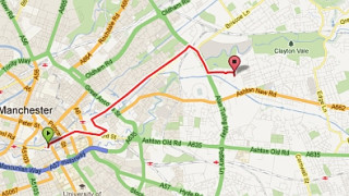
Members can now map their rides, access over 300 approved bike routes and download the favourite rides of some of the stars of the GB Cycling Team thanks to a new online tool – British Cycling Mapping – which has been launched today.
Available at www.britishcycling.org.uk/mapping, British Cycling Mapping allows users to create, edit, save, upload, rate and share their cycle routes. As well as being able to view routes in Google Maps, they will also be able to use Ordnance Survey Maps with much more detail, including a 1:25,000 scale, perfect for avid off road cyclists and race organisers.
Some of Britain’s leading riders have already got in on the act, with Lizzie Armitstead mapping a ride around her Yorkshire roots and Emma Pooley sharing her favourite route which takes in the North Norfolk coastline. These are all available to view and download exclusively through British Cycling Mapping for members to try out themselves.
In addition to the map viewing, British Cycling Mapping has a number of features that allows users to plot routes from scratch, use auto routing with fastest and quickest route options and a number of search terms that are categorised by distance, bike suitability, elevation, topography and difficulty level.
Gavin Finch, Membership Marketing Manager said: “Over the past few years we’ve seen a huge rise in the number of people riding their bikes. In line with the sustained growth of the organisation and the sport as a whole, British Cycling Mapping will help continue that popularity, with people enjoying their cycling even more.
“It’s another fantastic benefit for our members. Whether it’s commuting, going on a club run, or racing on and off road – British Cycling Mapping enables every member to plan their favourite routes as and when they want. As well as all that, it will also help us build on our relationships with event organisers, who can use it in conjunction with our online event calendar to plan their events.”
British Cycling Mapping has three available options:
Taster: Available to all britishcycling.org.uk vistors – limited functionality with a sample of British Cycling Approved routes available to view but not amend, whilst routes can be mapped but not published, saved or printed.
Standard: Available to all British Cycling members – access to Google and Ordnance Survey (1:50,000 scale) maps. All British Cycling Approved routes can be accessed along with the favourite routes of some GB riders, and users can map their own routes, download to GPX, publish, rate, edit, save and print.
Premium: Upgrade available to British Cycling members for an annual payment of £20-£25 with all of the above plus access to Ordnance Survey 1:25,000 scale maps providing a more detailed view which is ideal for off-road cyclists and event organisers.
British Cycling Mapping is the latest addition to a membership package available from as little as £24 per year which also includes a range of benefits from liability insurance and free legal help to discounts with top cycling retailers.
For an online video guide and to find out more details about how to make the most of British Cycling Mapping, please visit www.britishcycling.org.uk/mapping.
For more information and to find out about the many benefits of joining British Cycling, visit www.britishcycling.org.uk/membership


