Event: 26 May 2013
Location: Woodford Community Centre, Woodford, Cheshire
Preview: Event Organiser
Entries are now open for the 2013 Polka Dot Challenge Sportive, also known as the 'Spud Riley'. There have been some big route revisions for this year and the menu has expanded to three route distances, but that essential Peak District flavour remains.
This event should be on everyone’s ‘one to ride’ list and the 2013 event is taking place on 26 May 2013. The event has run for the past 10 years and this year it promises to be better than ever with a revised route to freshen things up, taking in the rugged Peak District and beautiful Staffordshire moorland areas, there are three route options of 30, 60 and 97 miles. None are easy options and the rides make the most of what is a superb cycling area.
The 30 mile ride has six listed climbs. The green lanes to Pott Shrigley are pleasant enough, but beyond the village the road rises up into the Peak across Bakestonedale Moor to Charles Head, then there is Wingather, Goyt and Long Hill. There's stunning views to be had whilst you catch your breath.
The run back takes in lovely Kettleshulme before a reverse of Bakestonedale Moor in a downward direction takes you back onto the Cheshire plain. Further refreshments are to be had at the HQ. It may only be 30 miles but it's a route packed with excellent scenery and some very challenging terrain.
"From Longnor, the road climbs high up onto the Western Flanks of the Peak Plateau. Leg sapping lanes crossing a big landscape where you ride against the flow of all streams. It's worth the effort once you reach Morridge and see the views across to the spectacular rock formations of the Roaches."
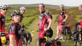
Polka Dot organisers on the revised 2013 route
The 60 mile route gets tough after only seven miles. Blaze Lane and the climb to Blue Boar Farm is a difficult two miles where you will witness the change from wooded, leafy Cheshire into rugged Peak District Moorland. You won't actually cross the border until the top of the next climb, known locally as Jenkin's Chapel. Built in 1733, this little church lies on a route used to bring salt from the Cheshire plains into Derbyshire on the back of ponies. You will no doubt be losing some salt up here yourself.
After some rapid descending, the road climbs steadily through the beautifully wooded Goyt Valley and beyond to the wild moorland of Axe Edge. Through Earl Sterndale the road descends a gap in the local edge and down to the fledgling River Dove. Soon after, at the pretty village of Longnor is some welcome refreshment.
From Longnor, the road climbs high up onto the Western Flanks of the Peak Plateau. Leg sapping lanes crossing a big landscape where you ride against the flow of all streams. It's worth the effort once you reach Morridge and see the views across to the spectacular rock formations of the Roaches.
It gets better as you traverse the northern end of the Roaches before dropping down to Meerbrook. Gun Hill next and into the twisting lanes crossing the River Dane before climbing up to Wincle. The ride beyond and through Wildboarclough is one of the most idyllic in the area and fortunately, for tired legs, its gradients are gentle.
The road past Lamaload Reservoir is not so easy and on to Charles Head where some further climbing is to be undertaken. From here, the ride drops off the Peak for the last time and makes its way back to the Cheshire HQ. A 60 mile ride you're not likely to forget in a hurry.
The longest ride takes in nearly all of the previous route. From the feed at Longnor, we sink into the deepest recesses of the Manifold Valley. It's quintessential Derbyshire with farms and mills dotted along the river's edge.
Briefly leaving the valley and climbing up through the quiet village of Butterton, you get a real view of the expansive moors in this south west corner of the Staffordshire Moorlands, high above Leek.
After traversing the ridge above Dovedale, we come back to the Manifold again and make our way up to Throwley Hall. The building is long since ruined and the road is said to be haunted by a coach and horses which lost control and ran off the road killing all of those on board. Beware also the blonde haired child who walks the ruins.
Very much into Staffordshire now, the route finds its way to the Weaver Hills. Edward Aughton, a cyclist at the turn of the last century wrote “Aloft the Weaver Hills one can see across the counties of Staffordshire, Shropshire and clearly spy the Wrekin and Welsh lands beyond.” He wasn't wrong and if you get a clear day, the southern aspect of this high ground will give you some fantastic views.
Ipstones Edge leads on to Morridge and runs for a good 7.5 miles to the Winking Man public house, where the route rejoins the previously mentioned 60 mile route back to the HQ.
 There are some 15 listed climbs and others to deal with on this longer route. It's a big day out and covers a lot of ground across the more southerly aspects of the Peak and Staffordshire Moorlands area. It's a fantastic route that won't leave anybody but the unfit disappointed. It is difficult terrain and you should be aware of that when entering the event.
The event has established itself as one of the UK’s ‘must ride sportives’. Check the diary, book in the date and get your entry in – you won’t regret it!


